Monday, January 31, 2011

Redwoods, Gnarly Trees and Lots of Mud


On Saturday, because the weather report said it was NOT going to rain on Saturday, we headed out for our weekly hike. This time we went down to Novato, and hiked the Big Trees Trail, which is in the Indian Tree Open Space Preserve.

This was so unexpectedly pretty, in spite of, or more likely because of the foggy misty drippy weather. The trail starts out with switch backs heading up through gnarly trees, and after about a half mile, you hit your first redwood grove. The trail continues through oak, and redwood groves all the way to the top, occasionally popping out into clearings, so you can enjoy the view. Of course in our case the view was mostly fog, but still it was very pretty.

I don't know how it is that we did not discover this trail sooner. I love Redwood trees, and I love gnarly trees, so this hike was perfect for me. We did a little under six miles round trip, and gained 1,440 ft. of elevation. My legs were feeling it next day too!


As you can see it was pretty foggy, the sort of weather that redwood trees thrive on. You could hear the rain dripping off the leaves and hitting the ground, and when a breeze would blow through you could swear it was raining.

The trail was muddy, but that didn't stop us, it might have slowed us down a bit, but it didn't stop us.

We saw dozens of these little guys (salamanders? Newts?) all between about 1" and 4" long. They were all headed to the other side of the trail, for no reason that was obvious to us. I wish I could tell which direction they were heading, but the compasses on my walking sticks each point in total opposite directions. So they were either heading West, or East, depending on which hiking stick I was looking at.


After our hike we found a spot for a cold beer, followed by a hamburger and fries and a glass of very nice zinfandel. All well and good, but if I'm going to actually lose some weight I need to find another way to reward myself at the end of each trail.


I'd love to go back and do this hike again. Every turn was beautiful, the views in the fog were so pretty, and the parts through the redwoods were peaceful. Except for a lone runner, and another small group of brave souls, we had the entire park to ourselves.


I know its a small accomplishment, but from one month ago, and our hike at the Pomo Canyon until now, I can really feel a difference in my fitness level. While I'm not planning to run a marathon, and I'm still always the last one off the trail, it is amazing how quickly the body responds to even moderate levels of exercise.


Beautiful Redwood Groves. I can't wait to do this hike again, and to share it with our friends we haven't done this trail.

Monday, January 24, 2011

The Elusive Muddy Hollow Trail

Last year about this time, we headed out towards Limantour beach, because we had read the Muddy Hollow Trail was a very nice hike, and you could start the hike from the beach, and make a loop ending up back at the Beach. Well, that was not entirely true. The portion of the trail from Limantour Beach to the Muddy Hollow trail was closed, so we ended up walking on the beach to the end of the spit and back again, which was beautiful. It was, like yesterday, a beautiful Northern California day, dry and upper 60's.

Yesterday we headed out in search of the Muddy Hollow trail again, and this time, armed with maps and a hiking guide, (California Hiking, The Complete Guide to 1,000 of the Best Hikes in the Golden State) we found the trail head. We arrived around 12:15 and after changing shoes, adjusting trekking poles, discussing the need for sweatshirts or not, we headed out to do the Muddy Hollow loop. According to the map the loop is 7.5 mi. The trail goes through all sorts of terrain, open grass lands, forests, over small creeks, and up on a bluff overlooking the ocean.

The view of the Farallones Islands was the most beautiful I had ever seen. Normally you are lucky to see some dark shapes off in the haze, but yesterday you could make out the actual shape of the islands. My camera is not good enough to really do the view of the Farallones justice, and of course the light was all wrong, but if you look carefully you can see them off in the distance.

We stopped on the bluff to have our lunch after having gone about 2.5 mi. (according to my pedometer, accuracy of which is suspect).


It took us almost 4 hours to do the entire loop. We got back to the car at just 4:00 pm, tired and hungry.

I'm the slowest in the crowd, so if it weren't for me, the others would have finished the loop a lot quicker, I'm sure. Not only am I slow, but I stop often to take pictures.

I love it when I find a gnarly tree to photograph.


This hike is part of the Pt. Reyes National Seashore. You can read all about the other hikes and download maps here

Sunday, January 16, 2011

A Walk in the Park

Yesterday was a perfect Sonoma County Day, sunshine, mid 60's, perfect for a walk in the Park-- Helen Putnam Regional Park.

The park is close to home, you can park for free in on the neighborhood side, or pay $6.00 if you park in the parking lot. We opted for the free Parking.

Even though the park is on the edge of Petaluma, once you start up the trail, you feel miles away.

We weren't the only ones out walking. The park was full of families, joggers, bikers, people walking their dogs, people riding horses, people walking their dogs while riding their horses.


The views were lovely, some a reminder that you weren't that far from civilization.
.
This is a shot facing east. You can see Petaluma off in the distance.

There are benches scattered through the park so you can stop and enjoy the views, which we did. We found a nice spot to stop and have a bite to eat.

According to my pedometer we went 2.09 miles, but according to the map we went 3.4 miles. Maybe it's time for a better pedometer.


Here is one of those spots that makes you feel far away from civilization.


The park has a lot going for it, its close to home, there are lots of trails so you can walk as long or as short a trek as you're in the mood for. The views are pretty, there are lots of people, so I didn't worry about mountain lions.


Facing south, from the south loop of the walk.


And this shot, just because I love gnarly trees.

We were told to come back in spring to see the wild flowers, which we will definitely do, but I think we will probably go back before then.

Thursday, January 13, 2011

Heading to St. Croix, US Virgin Islands!

I mean look at this place...who wouldn't want to go there?

We’ve been invited to a Wedding being held on St. Croix, US Virgin Islands, and I say what better opportunity for a little get-away.

The wedding isn't until end of April, but we have our airline tickets, hotel reservations, and passports already packed!


We’ll be staying at the Hibiscus Beach Resort.

I've been busy researching things to do and see on the island. For me, half the fun of going on vacation is the preparation and anticipation, which is particularly fun on a grey dreary day like today.

Besides just relaxing on the beach (which is what most normal people do), there is a botanical garden , the Cruzan Rum Factory, Buck Island Reef National Monument, and the usual island things: diving, canoeing, kayaking, and fortunately for us, Hiking! We have to continue getting into shape for the Milford Track even on vacation. And because we aren't the kind of people who just relax on the beach. No, not us. We have to go go go, till we practically kill ourselves seeing everything, doing everything, until finally we have to drag our sorry butts home to recover from our "relaxing vacation."

You can expect a full report when we get back, but you'll have to wait until May.

Now what knitting to take? it will be hot, muggy... socks perhaps? something in Linen?

Monday, January 10, 2011

Countdown to the Milford Track

Yesterday we went on the first Hike I’ve been on in almost a year. It was not only a beautiful hike, but a good indicator of how much work I have to do to prepare for the Milford Track.


We hiked the Pomo Canyon Trail / Red Hill Loop. (The hike and beach are part of Sonoma Coast State Park).

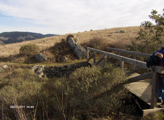
Since the campground is closed this time of year, we had to park on the road and walk the half mile to the trailhead. About a mile up the hill through beautiful redwoods, the trail makes a fork, where you can continue on the Pomo Canyon Trail to Shell beach (as described in “clip and go”, and was our original plan), or head up Red Hill (elevation 1060), which is what we did. The trail up to the summit goes through grasslands, over a creek, and through another small redwood grove.


From the Summit, the views of the ocean and Russian River are spectacular. To the East we could see the steam coming up from the Geysers, forming a cloud over the mountain top. We had our lunch, enjoyed the views, and then headed back towards Shell Beach.

This trail eventually takes you to another fork, where you can head to Shell Beach, or take the Pomo Canyon Trail back. It was getting late, and we were concerned about running out of daylight, so we didn’t go all the way to Shell Beach. We headed back on the Pomo Canyon trail, completing the loop. Just past the fork is a little outcropping with a picnic table. We stopped there for a minute or two, enjoyed the view, and rested our feet a bit before continuing on.


The hike goes through Redwood groves, grasslands, over creeks, and this time of year, LOTS of mud. On most scales, the hike is given a “moderate” rating, but in my couch-potato-condition, I give it a “difficult” rating. Let’s see a year from now if it still feels like a “difficult” hike to me.


I particularly liked the redwood groves. There is something very peaceful about stands of redwoods, and even though the trail was very muddy in spots, the recent rains also had the creeks running. It’s a beautiful hike and we weren’t the only hearty souls out on a cold January Day enjoying the fresh air, sunshine and views. I’d like to go back in spring or summer, when the days are longer, and the trail not so muddy.

The loop we did was probably 7 mi., including the half mile walk from the road to the trailhead. We didn’t follow the Pomo Canyon trail as described which gives the distance as 5.5 mi. roundtrip on the Pomo Canyon trail. (NOTE: The “clip and go” is a bit outdated. The trail hasn’t changed much, but parking is now $8, not $3 as mentioned in the link)


Towards the end of the hike, which took us about 4 ½ hours, my legs were starting to shake, my feet hurt, and I had some nice blisters. It’s obvious I have my work cut out for me to prepare for the longest day of the Milford Track. Day 3 is 9 miles and gains approx. 3000 ft. in elevation. Depending on when we book our trip, I have 10 – 11 months to get myself in shape.

Can I do it?